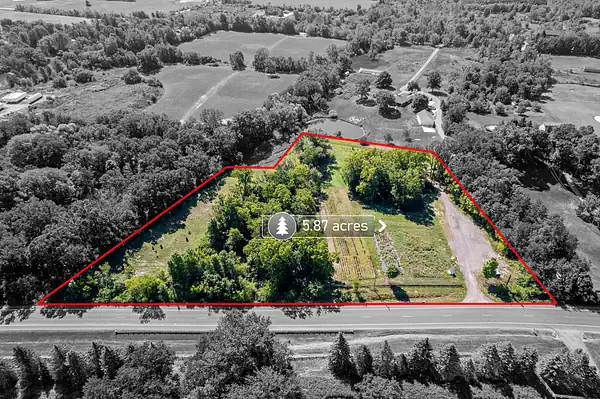
I walked a four acre piece outside Mukwonago last spring with a buyer who had already picked a house plan. Decent road frontage, mature oaks along the back line, and a soft green stripe running diagonally through the middle of it that was still holding water in April. He wanted to know if he could just fill it. The honest answer was that nobody standing in that field, me included, had the authority to tell him.
Wetland and floodplain are the two issues that most often change what a parcel can become, and they are also the two that get mixed up the most. Here is how I explain the difference, and the order I would chase the answers.
They are not the same thing
A wetland is defined by what is physically there: the soil type, water at or near the surface for part of the growing season, and the plants that grow in those conditions. A wetland does not have to look like a pond. Plenty of them look like a slightly low spot in a hayfield.
A floodplain is defined by modeling, meaning the area a mapped flood event is expected to reach. A parcel can sit in a mapped floodplain with no wetland on it at all, and it can be loaded with wetland and sit nowhere near a floodplain.
They matter for different reasons. Wetland tends to limit where you can disturb ground. Floodplain tends to drive how you have to build, and what it costs to insure.
Who actually decides
Not me. I am firm about this with clients, because getting it wrong is expensive and I am not licensed to be the one who is wrong.
- Wetland boundaries come from a delineation performed by a qualified wetland professional. The Wisconsin DNR is the state agency involved in wetland identification and in permitting work that affects wetlands.
- Work affecting certain waters and wetlands can also trigger a federal review by the U.S. Army Corps of Engineers, which runs separately from the state process.
- Floodplain limits are administered locally. The county or municipal zoning office applies floodplain rules to a specific parcel using the applicable flood maps.
- Where any of those lines actually fall on the ground comes from a surveyor.
- Whether a septic system can be sited comes from a soil tester and the county, not from a wetland map.
Every one of those offices will talk to you before you own the land. In my experience they would much rather answer a question early than deal with a violation later.
Online maps are a screening tool, not an answer
State and federal mapping is genuinely useful. It will tell you quickly whether a parcel deserves a closer look. What it will not do is establish a boundary you can build to. Mapped wetland inventories were assembled at a scale that is coarse relative to a single building envelope, and flood mapping is produced for insurance and regulatory purposes, not to locate your garage.
I have seen parcels that mapped clean and then delineated with wetland running through the best part of the site, and parcels that mapped half covered and came back with a buildable envelope right where the buyer wanted the house. Both directions happen.
If the only thing standing between you and a decision is a map you pulled up on your phone, you do not have an answer yet. You have a reason to ask a question.
The order I would run it
- Pull the parcel on the county land records and note the zoning district plus any shoreland or floodplain overlay.
- Check the state wetland mapping and the applicable flood maps as a screen. Treat whatever you find as a flag, not a fact.
- Call the county or municipal zoning office with the tax key number in hand. Ask which overlays apply and what they require.
- If the screen shows anything, get a wetland delineation ordered while you are still inside your inspection or feasibility window.
- Run the soil test for septic in that same window if the parcel is not on sewer.
- Get a survey that puts the delineated line, the required setbacks and your proposed envelope on one drawing.
Run in that order, you spend a little money to find out whether to spend a lot. Run out of order, people buy land and then learn what they bought.
What it does to a build
When wetland or floodplain is present, the practical effects show up in a few predictable places. Setbacks measured from a wetland edge rather than from the lot line can shrink a buildable envelope more than people expect. A driveway that has to cross a drainageway becomes an engineered crossing instead of a gravel lane. Floodplain can drive elevation requirements for the lowest floor and affect insurance. Stormwater handling becomes a design item instead of an afterthought. None of that makes a parcel unbuildable. It makes it a different parcel than the one in your head, with a different budget.
When I tell people to walk
I am willing to say when something is a bad idea. If the delineated wetland and the required setbacks leave no envelope that fits the house you actually want, and the only path forward depends on a permit nobody can promise you, that is a walk. If the seller will not give you a feasibility period long enough to get a delineation and a soil test done, that is also a walk. Raw land is the one purchase where the contingency period is most of what you are buying.
If you are looking at a parcel in southeastern Wisconsin and cannot tell what you are looking at, send me the address or the tax key. I will pull the parcel, run the screening maps with you, and tell you which office to call first. If it looks like it needs a delineation, I will say so, and we will build that timeline into the offer instead of hoping.